
The Green Wall
,
Josh was out exploring nature this week and came across the Antonine Wall! This is sadly Josh’s last post for us, he has came to the end of his project. We would just like to thank Josh for all the hard work he has put in for us creating these amazing blogs. We wish him well for the future!
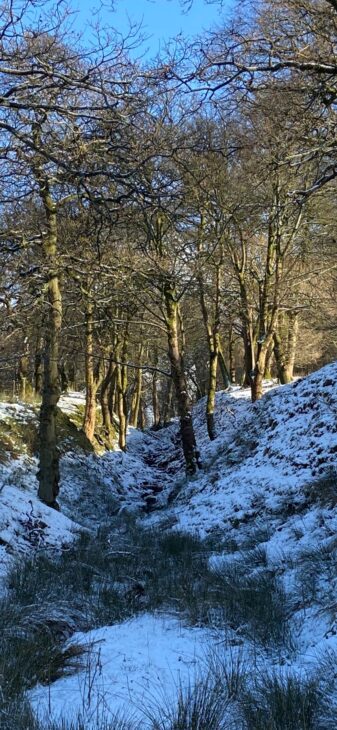
“For my final post, I have chosen to write about the Antonine Wall and Roman history. During the lighter snow this week I managed to get a good photo of the massive ditch the Romans dug beside the wall. The Antonine Wall was the most northerly barrier of the Roman Empire in the UK. The Antonine Wall portrays how far the Romans conquered Scotland. It took 12 years to fully complete. It was 10 feet high, 16 feet wide and 39 miles long. The Wall was protected by 16 forts all armed with soldiers. Fortlets were in between these 16 forts. The Wall was abandoned eight years after its completion due to the Roman Legions retreating to Hadrian’s Wall. Westerwood was the site of one of the Roman forts and also where this picture is from. Croy Hill and Castlecary were the nearest forts to Westerwood. Larger forts, like Castlecary, usually housed around 1000 men. The Roman Empire never fully conquered all of Scotland but did conquer a lot of Europe”